
Maps and Photos
Old Aerial Photos
The Virginia Tech Library has from its geology library a large collection of aerial photographs from various time periods covering different counties in Virginia. There are photos from the 1930s, 1950s, and 1970s.
Lynchburg
This street map is from 1927 and shows the rail lines, stations, and the streetcar system.
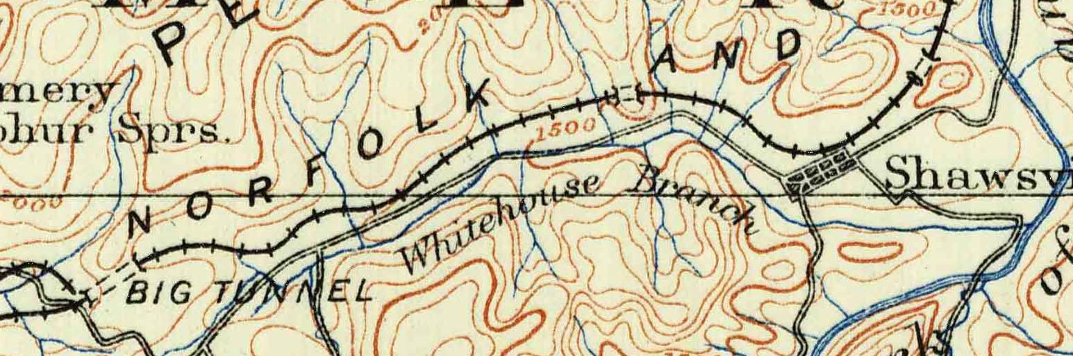
Topo Maps
These were downloaded from the USGS Map Locator and Downloader site.
VA_Christiansburg_188892_1890_125000_geo.pdf
VA_Christiansburg_188892_1890_125000_geo.jpg
VA_Blacksburg_187828_1937_62500_geo.pdf
VA_Blacksburg_187826_1932_62500_geo.pdf
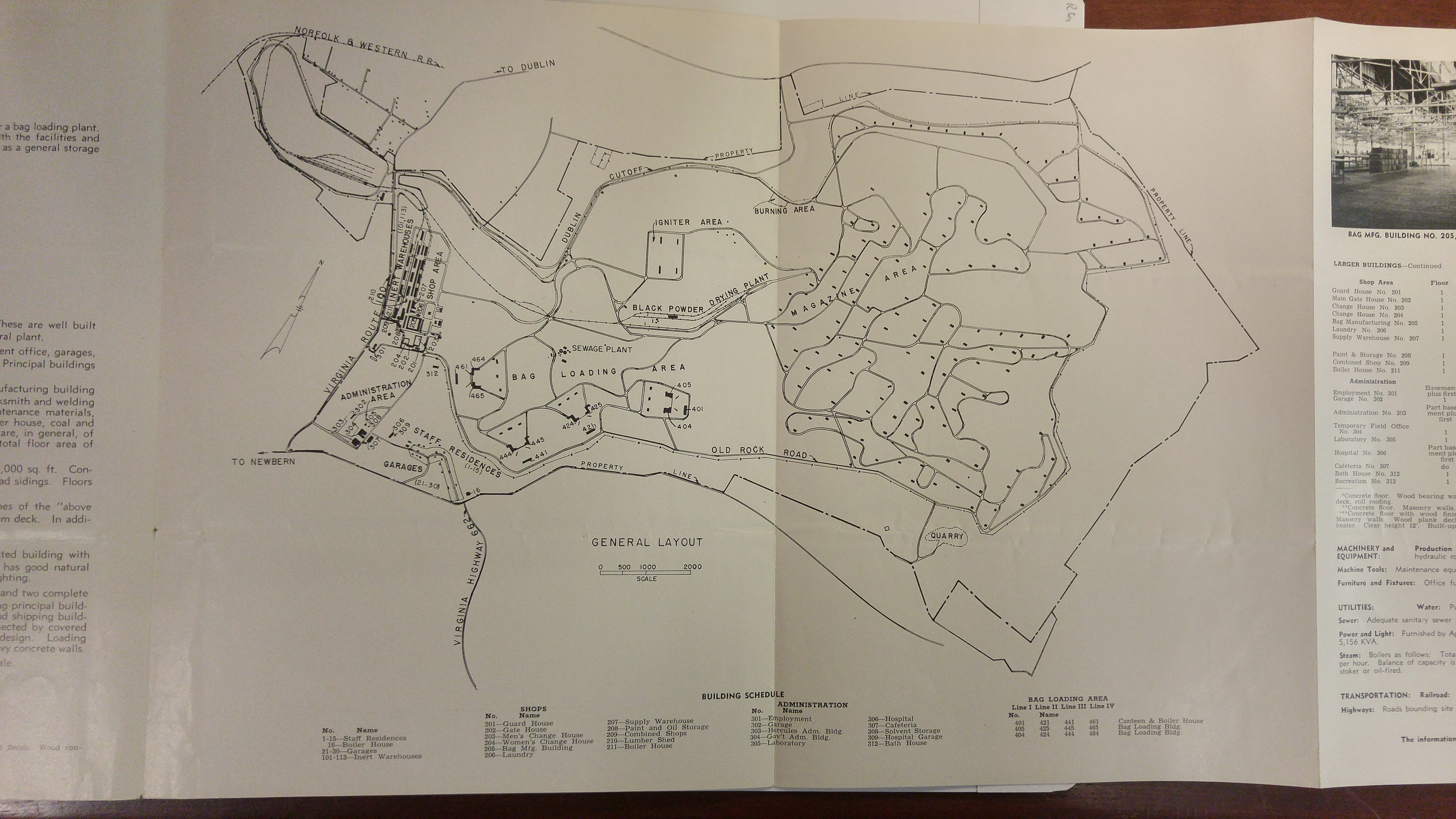
Radford Arsenal -- New River Unit
The New River Unit of the Radford Arsenal in Dublin was known as the “Bagging Plant” since that is where powder from the main plant was put in cloth bags as charges for large guns, such as on battleships. This map from a post-WWII brochure shows the branch off the N&W and the track layout within the plant. Much of the property was declared surplus after the war and the brochure was promoting the site for industrial development. Parts of the property were released for private use, but the area with magazines (some of which are still in use) is still under government control. The branch, which also served a furniture factory, is long out of service.