
Warning: include(../../topbar.php): Failed to open stream: No such file or directory in /home/bhsaft5/public_html/nwhistory/vgn_info/ArsenalSpur.php on line 33
Warning: include(../../topbar.php): Failed to open stream: No such file or directory in /home/bhsaft5/public_html/nwhistory/vgn_info/ArsenalSpur.php on line 33
Warning: include(): Failed opening '../../topbar.php' for inclusion (include_path='.:/usr/lib/php:/usr/local/lib/php') in /home/bhsaft5/public_html/nwhistory/vgn_info/ArsenalSpur.php on line 33
Virginian Research
VGN Spur into Radford Arsenal
I saw a hint of the spur on a topo map on http://www.terraserver-usa.com (the site was shut down in February 2020). It showed an “Abandoned” line inside the arsenal directed toward the VGN line, and, with a vivid imagination, I could barely make out some dashes outside the arsenal leading to the VGN. I wanted to check a vintage topo map on http://historical.maptech.com/, but I kept getting the message “currently not available.” So, I got out a 1950 15-minute paper topo map (that I should have looked at to begin with), and it clearly shows the spur branching off immediately west of the VGN’s New River Tunnel (the name shown on both 1953 VGN and 1987 N&W track charts). It also shows this spur connecting inside the Arsenal with the N&W spur that branched off just short of the east end of the N&W’s bridge over the New River immediately east of Cowan Tunnel (the name shown on 1987 N&W track chart).
Gordon Hamilton
Tue, Jul 1, 2008
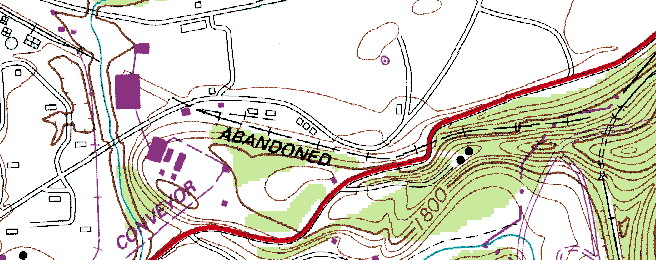
Radford North, Va. 7.5-minute quad -- 1965, photorevised 1984

Aerial image showing spur. The 480-foot tunnel is listed as “New River Tunnel” on N&W track charts, and as “Milletts Tunnel” on VDOT maps. From the Geographic Names Information System (GNIS):
- Feature ID:
- 1674626
- Name:
- Milletts Tunnel
- Class:
- Tunnel
- Citation:
- County highway maps published by the State Department of Transportation. Usually updated annually. The year of publication follows (if known): 1987
- Entry Date:
- 13-Nov-1995
- Elevation(ft/m)*:
- 1923/586
- Latitude(DEC)
- 37.1870715
- Longitude(DEC)
- -80.5147772
- Latitude(DMS)
- 371113N
- Longitude(DMS)
- 0803053W
- Map Name
- Radford North
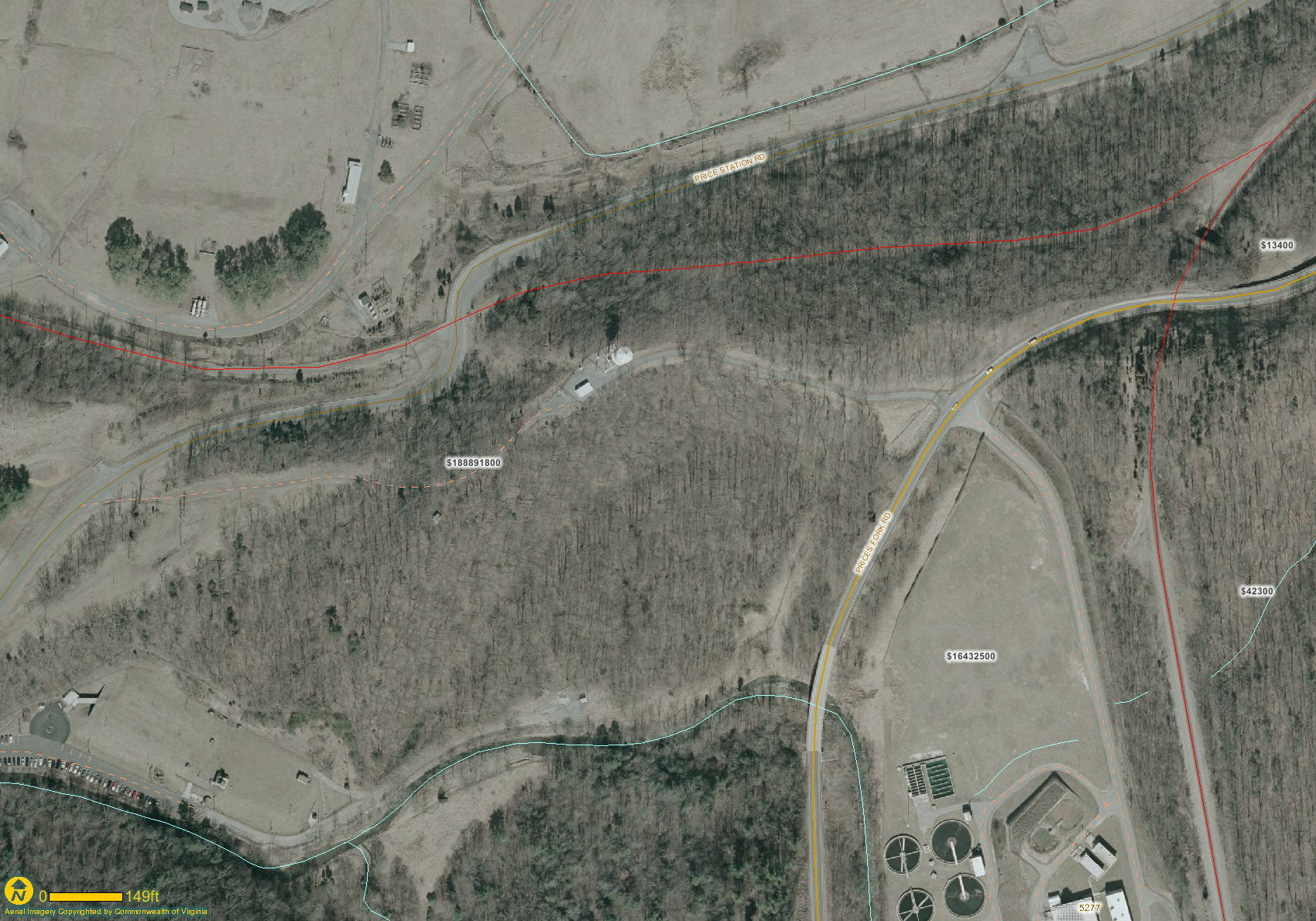
Aerial image showing spur at higher zoom
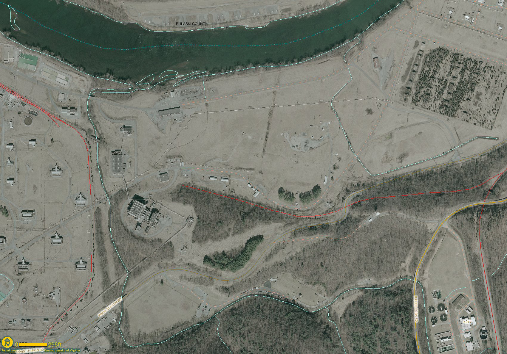
Another image showing spur in the aresenal. It isn’t difficult to see where the line once connected to the rest of the plant rail system.
From H. Reid’s Virginian Railway appendix “A historical chronology, 1898-1959” comes several items of interest.
1912“Non-self-supporting tunnels to be concrete lined; Hales Gap, Slate Hill and New River so treated.”
Kellysville Crossover/Connection
See the Kellysville page for this topic.
Bruce Harper, July 1, 2007