The Old Main Line
The original route of the Norfolk and Western in Southwest Virginia was from Roanoke to Bristol via Radford. When the Pocahontas coal field was opened, the best route for the new line to serve this area was down the New River to Glen Lyn, then up the East River and on to Bluefield.
The surveyors and builders took a “shortcut” around the twists and turns of the New River between Radford and Belspring. The new line started in New River, at the west end of the bridge across the New River. The line ran east and paralled the hillside to a gap, then turned north. It climbed from 1,768 feet at New River to the top of the grade at Schooler, elevation 1910 feet, then dropped to the river at Belspring, elevation 1,769 feet (see a profile of the route today).
The line was improved with the addition of a second bridge from Radford across the New River, which allowed for a direct connection to the new line. Prior to this, trains were required to back into or out of Radford, or engines had to run around the train at New River.
Because of the steep grade on both sides of Schooler Hill, the “Walton Cut-off” was built from Walton east of Radford to the existing line at Belspring. The line ran down the New River, crossed the river downstream from Peppers Ferry, and went through Cowan Tunnel to avoid a long horseshoe bend in the river.
The old main line was abandoned and exists today as Va. 600, Belspring Road. The second bridge was removed, with a portion of it being reused on the North Carolina Branch. The bridge piers still remain.
“Railroad archeologists” are trying to determine where parts and pieces of this line existed and how the line was operated.
The Pulaski County GIS system, with aerial photographs and parcel lines, helps define where parts of the line were. You can zoom in close with high resolution. With the view zoomed in to where the scale reads 1320, it is easy to see Crosstie Lane in Parrott. See a view of Parrott and Crosstie Lane as the probable location where the original main line left the river. There is an interesting triangle in the property lines there, marked with the blue box, which seems to indicate where the original line came off the river. The shaded area in the image is a detached parcel from the current main line but still owned by Norfolk Southern. See a view of New River for the layout at the end of the bridge and location of the line along the river.
(From my research notes -- Bruce)
Norfolk & Western Railway, 3rd Annual Report, June 30, 1899, pg. 10
Attention was called in our last report to the necessity of reducing grades wherever practible. . . In pursuance of this policy the construction of a low grade branch line, near Radford, has been authorized. This branch is 7.2 miles in length. It leaves the Main Line near the mouth of Crab Creek, near the 289 mile-post from Norfolk, and rejoins it near the 309 mile-post, near the mouth of Back Creek. The construction of this branch shortens the haul 4.3 miles, and reduces the controlling grades between the points named from 78 feet per mile east bound and 86 feet per mile west bound, to 11 feet per mile east bound and the maximum curvature froom 14 degrees to 6 degrees. The work of gradation is heavy and costly, owning to the necessity of bridging New River and piercing the high hill in the bend of that river by a tunnel, about 3,500 feet long. The entire cost of the Branch is estimated at $415,000, of which sum $300,000 has been charged to Surplus Income as above mentioned. . . The work of grading the Branch has been commenced and is being prosecuted with vigor.
Norfolk & Western Railway, 4th Annual Report, June 30, 1900, pg. 10
Good progress was made during the year in the construction of the low grade branch line near Radford, to which attention was called in our last report. This branch will be opened to traffic early in October.
Norfolk & Western Railway, 5th Annual Report, June 30, 1901, pg. 12
New River Connecting Branch: This line was opened for traffic October 11, 1900. The Company has accepted an Act of the General Assembly of Virginia, approved February 15, 1901, authorizing the abandonment of the old high-grade line between New River Depot and Back Creek, in Pulaski County.
Pg. 71 Tower and interlocking plant of 40 levers was erected at Walton. Combined freight and passenger station, 24' x 61', was erected at Pepper.
Norfolk & Western Railway, 6th Annual Report, June 30, 1902, pg. 64
Belspring station building removed from old location on High Grade to new location
See pertinent information about Pulaski and the old main line from the Virginia: a Hand-book Giving Its History, Climate, and Mineral Wealth: Its Educational, Agricultural and Industrial Advantages published in 1893.
Collected Information from the N&W Mailing List
Another piece of information is needed here. The original line through Radford and over Schooler Hill included 11 miles from MP 298 near the mouth of Crab Creek to MP 309 near the mouth of Back Creek. When the new low-grade line was constructed the line was about four miles shorter and the mile posts were numbered 302 to 309 from Norfolk; specifically the MP 309 remained the same and the old MP 298 became new MP 302.
Today when proceeding from Vicker to Walton, the last mile post before Walton is MP 297 and next one is MP 302 which is near Walton. MP 309 is near Parrott. The old reports said the Schooler line ended near the mouth of Back Creek near to MP 309.
Bud Jeffries
See the 1970s vintage track chart that shows how this mileage was “fudged” by the engineers.
(In response to: “Another piece of all this is the helper operations on this line. Were the pushers stationed at Parrott/Belspring (and what facilities were there?) or were they dispatched from Radford as needed? Or did they just shuttle back and forth, pushing empties west, then pushing loads east?”)
I do have one tidbit regarding pusher service. According to old surveyor's notes in the Archives, a small turntable was located at New River at the end of the bridge along the line leading to Bristol. This may have been used for turning the helpers after coming over the hill. It is my suspicion that the helpers worked all the way over the hill and then worked back the other direction. Remembers that big power in that day were 4-6-0's and 2-8-0's.
Ron Davis
The turntable could have been used to turn the headend power to reverse direction after leaving Radford to proceed on the Schooler Hill line.
At New River there were multiple tracks so the engines could run around the train to the other end. It is also very possible that the locomotives could have left Radford running tender first to New River and then moving to the headend for the run toward the coalfields.
I have nothing that says how this operation was worked, but whatever it was, it was awkward and very expensive to do. The elimination of Schooler Hill was the first major line relocation of the new N&W Railway after 1896.
Bud Jeffries
1901 N&W Annual Report
“NEW RIVER CONNECTING BRANCH:
“This line was opened for traffic October 11, 1900. The Company has accepted an Act of the General Assembly of Virginia, approved February 15,1901, authorizing the abandonment of the old high-grade line between New River Depot and Back Creek, in Pulaski County.”
1902 N&W Annual Report
“Belspring . . . . . . . . . . . . . . . . . . . . ; Station building removed from old location on High Grade to new location.”
Gordon Hamilton
N&W Annual Report 1888
“Bridge 600, a new bridge composed of two deck plate girders each 54 feet long, and six spans deck Pratt truss, each 129 feet 5 inches long, with two abutments and seven piers. Was built at Eastern Connection New River Branch.”
Gordon Hamilton
Photos
Station at Pepper (rear view)
BH Tower at Walton (1942)
Tower at Walton (original construction?)
Tower at Walton (copy of glass plate?)
Belspring Station (glass plate version of above)
Tipple at Parrott for Pulaski Anthracite Coal Co., in Pulaski between 1900 and 1905.
Bridges at Radford 1886
West Radford Station and Radford Inn, 1890s
Radford Land and Improvement Map 1888
Train Load of pipe Radford,Va. 3/20/30
Cowan Tower 1929
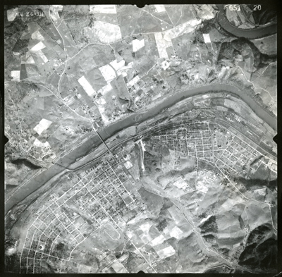
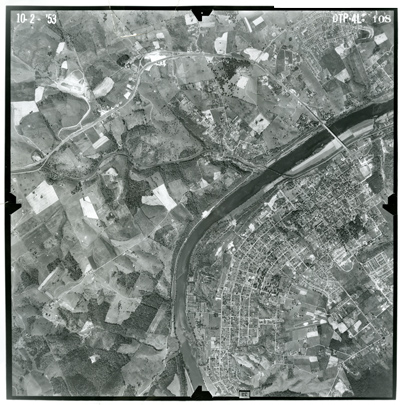
Aerial Photos from Different Eras
Full-size image 4.5 Mb file
Full-size image 28.4 Mb file in all its 25 in. by 25 in glory (453.7 Mb Photoshop file available upon request)

 Radford, 1937 (2.4 Mb)
 Radford, 1953 (2.4 Mb)